March 14, 2018

Historical Farm Houses above the Gürbetal Valley near Berne

March 14, 2018 --  Spring weather teased us a bit this week... A couple of hours work in the morning and then off to the Berne area in just over 2 hours to enjoy a sunny afternoon hike (12 km) in the mellow pastoral countryside, with views of my favourite Bernese Alps, which view was actually the reason for picking this hike.

The trail is officially called the "Gürbetal High Trail" (Gürbetaler Höhenweg) which is a 28-km trail winding above the open valley between Berne and Thun (actually a glacier moraine), through which runs the Gürbe River. The area is known for its historical and fabulously well-maintained farm houses, which was a real treat, besides the view of course, and the tantalizing spring weather.

On the larger farms in Switzerland (especially also in the Bern area), additional buildings called "Stöckli" were erected for the elder farmers to live in once they passed the farm on to their heirs. We saw many such Stöckli along the way, some dating as far back as early 1700's.

Other interesting sights along the way: Here and there lie huge "foundling" boulders (or "erratics", as I recently learned they were called), remnants from 20,000 years ago when the Aar Glacier deposited them in this area after carrying them over 75 km. 

And a staple of the Swiss landscape: The farmers are out in full force raking leaves off their meadows and fertilizing with liquid pig manure, a smell that forms an integral part of the Swiss landscape. We were lucky the farmer had to take a break to "fill up" just as we passed the area he was working in. Can't imagine what being dosed with "pig manure perfume" might be like....


Spring is teasing us with the first snow bells (covered by snow again about a week later).

Some of the beautiful Bernese farm houses we passed along the way (top right is a Stöckli)

This magnificent structure was built in 1717 (a rather large Stöckli... at the very top they used to store grain, at the bottom was a cellar, and in the middle were the living quarters).

Our first view of the Bernese Alps as we cross through the meadows

Bears in the forest

This 4.5m high "erratic" is 20,000 years old and was transported here from 75 km away by the Aar Glacier (this is actually a glacier moraine)

We took a coffee break on a bench, and wondered how we would pass by this tractor without picking up the smell of the manure

Lucky for us, the farmer had to go for a refill, so we took advantage of the break and passed the spot where he was working....

Back there in the red circle is the bench where we had taken our coffee break.

This is a particularly pretty farm house.

The walking trail takes us right through the farm yards

And what would the Bernese farm be like without a resident Bernese Mountain Dog! The little structure in the photos is a Stöckli, built both as storage and for older generations once the farm has been passed to the heirs.

And now the first glimpse of the favourite Bernese Alps (Mount Jungfrau), a distinctive sight in Central Switzerland

This is a particularly pretty sample of a Stöckli. Usually there was a cellar below and an upper level to store grain, and in between were the living quarters.

Another coffee break, to enjoy the sunshine and the view (just a bare glimpse of Lake Thun at the foot of the Bernese Alps)

Enjoying the rare sunshine and Spring weather above the Gürben Valley

On the right is the small hamlet called Obertoffen which we passed through before descending back to valley bottom. Also, this was the view from our bench....
Finally the clouds have lifted to show the North Wall of Mount Eiger. But my favourite peak is Mount Finsteraarhorn, which is actually the tallest peak of the Bernese Alps ((4,274 m (14,022 ft))
More beautifully-maintained farm houses (this one is in Fallenbach, alledgedly one of the best-preserved old hamlets in this area).

I'm not sure what this structure is, but each "hamlet" had one. This one dates back to 1764.

One last snapshot of one of my favourite views: Mounts Finsteraarhorn, Eiger, Mönch, and Jungfrau)
This is the area where we walked, on the Gürbetaler High Trail in the Gantrisch Nature Park.

March 4, 2018

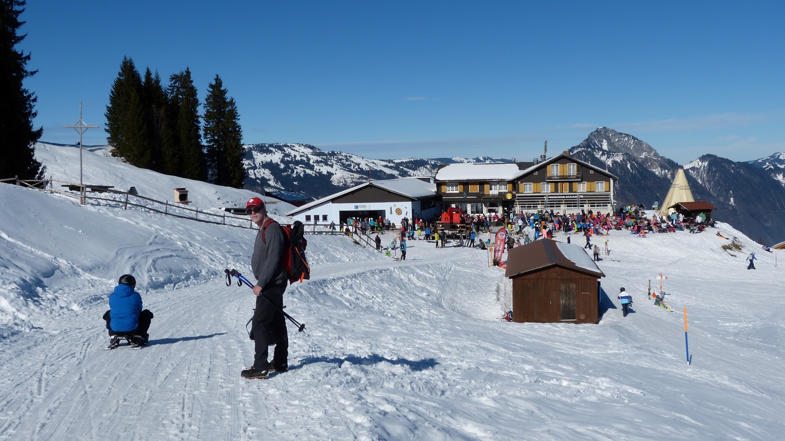
Snowshoeing on Klewenalp above Lake Lucerne.

March 4, 2018:  Tried snowshoeing for the first time, kind of liked it, I might do it again.

But never again in a family-oriented skiing and sledding region, on a sunny Sunday afternoon, on a trail touted as a snowshoe trail but really just a regular walking trail, something we could have done without the snowshoes.... plus we had to share the trail with all of the above (sledders, skiiers, walkers), and the PEOPLE, so many people, so long to wait for the cable car, buses crammed full of people with equipment...

We will have to rethink our destination next time. This was close to home, so the hope was to get there and back fairly quickly. But there are advantages to spending more time going to more remote locations....

BUT the feel of spring is in the air... (which probably means clouds and rain for the next two weeks....)


After waiting for three cable car trips (about 20 minutes), it's our turn up, but the waiting room behind the platform is still packed!

Below on Lake Lucerne is a wall of fog, which lifted shortly after we got up to Klewenalp.

View down on Lake Lucerne and the two peaks called Mythen. (Cities of Schwyz and Brunnen at the foot of those mountains)

Fog is cool if you don't have to be IN it.

This was our view as we found a sunny spot for a picnic lunch before trying out the snowshoes (At the South wall of the little chapel in Klewenalp)

Heading up the hill from Klewenalp
Looking back toward Klewenalp, there is the little chapel where other people have taken our place on the sunny South wall where we had a picnic lunch.


On the short stretch that was actually a snowshoe trail, but which we could have walked with regular shoes.

It was fun to try out the snowshoes. Sunshine was pleasant and the mountains were fantastic as usual.

Mountain landscape was fantastic as usual

I don't mind sharing the trail with this cutie!

In a spot where the mountain throws a shadow on the trail, and the sun lights the trees from behind 

So pretty how the sun lights up the trees from behind.

Usually we pick a sunny spot for our breaks.... this structure has seen better days.

This is our destination (Stockhütte) where we can take the gondolas back down to Emmeten. Lots and lots of people enjoying the sunshine here.

SO MANY PEOPLE!
As nice as it was up here, we headed back down to lake level right away.

Lake Lucerne, Mount Bürgenstock. On the promontory below is Beckenried, where we started with the cable-car ride up to Klewenalp.

As per usual, our excursion starts and ends with cable cars, and this time a short 6-km stretch in between.


February 21, 2018

Forest Hike from Cresciano to Osogna in the Riviera Valley

Wednesday February 21st, 2018 - This one was a relatively short hike, just over 5 km and only 300m ascent above a smaller granite quarry on the East side of the Riviera Valley. We ascended at Cresciano and came down in Osogna, passing mostly through forest strewn with humungous boulders, a popular area for practicing free-climbing. Our favourite spot this time was a lovely series of waterfalls and pools with stunning rock formations carved smooth by the water, somewhere we'd like to return to in summer for a swim... except we found out from the Internet later that this spot (Boggera River in the Cresciano Valley) is a popular place for canyoning in summer, so we'll have to see just how popular it is.... 

In the Ticino, the steep trails are usually "outfitted" with steps, either hewn directly into the rock or created by clever laying of stones and stone slabs.

After a short steep ascent we arrive at a community called "Sul Sasso" (translated means "On the Stone") on a pleasant sunny hillside.... they must get lots of sunshine here because there were many small vineyards.

The forest was strewn with HUGE boulders, a favourite area for practicing free-climbing.

This was our favourite place, the bottom part of what is apparently a series of pools and waterfalls created by the river Boggera (higher up) where you can go canyoning.

If it had been summer, we would have gone for a cold swim!

Higher up is a gorge replete with such waterfalls and pools, a popular place for canyoning.

This was our planned destination for lunch: The chapel called Santa Pietà overlooking the Ticino River

Picnic lunch on the granite steps of Santa Pietà

From this vantage point we get views South along the Ticino River....

...and views northwest to Lodrino and the granite quarry, above which we walked three days earlier (photos HERE)

Zoomed view of the town of Lodrino across the valley, start and end of the 11 km hike we did three days earlier.

Zoomed view of the granite quarry across the valley. The machinery gives an idea of how large the granite blocks really are.

Very happy to be able to enjoy the mild sunny weather in the South.

Our descent to Osogna, where we got on the bus to go back to Bellinzona.

Also here in Osogna is a natural pool (named Pozzon) popular with the locals in summer. Not the same river or canyon, although canyoning is also popular here. 

Parish church in Osogna

Colorful handpainted shrine in Osogna, a very pretty piece of artwork

The hike from Cresciano to Osogna was only 6 km, with an ascent of only 300m, but satisfying because we got to enjoy three hours of sunshine and mild weather.